Honest trail data for Tamil Nadu's forest and temple trails, computed from real routes and elevation, and an offline companion that tells you where you are, what's next and how to get back.
APK · Version 2.1 preview · 6.6 MB · Android 5.1 or newer
Thadam is Android-only for now. Open this page on an Android phone to install it.
Works offline52 m off route · turn back1,480 m of real climb
Two problems on every trail.
01
Trail information is wrong or missing
Published distances, climbs and start points are often wrong. Thadam computes them from real route and elevation data, shows the listed figure next to the verified one, and marks anything that isn't verified yet.
02
There's no help once the signal drops
Most trails have no network. Save a trail pack before you leave signal, and the map, the route and your position keep working all the way up and back.
What's inside
Everything you need on the trail, on your phone.
Verified trail cards
True distance, total climb, time for your fitness level, the steepest stretch and the summit height, computed from real route and elevation data.
Works with no signal
Download a trail pack with its map, 3D terrain, route and data before you set off.
Where am I?
Distance done and remaining, your altitude, the next waypoint and the nearest exit, at a glance.
Off-route alerts
Stray more than 40 m from the path and your phone buzzes and points you back.
Check in, check out
Check in when you start and out when you're back, so the trail office can see who's still on the trail. Saved on your phone, synced when signal returns.
Water240 mViewpoint1.2 km ↗Steep section60 m ahead
New in 2.1
AR trail signboards
Point your camera up the trail and see signposts for water, viewpoints, hazards and exits, placed using GPS and the compass. No camera? It switches to a compass dial. Works offline too.
Guide-recorded routes
Guides record routes and waypoints on the ground, offline. The trail office reviews them, and approved routes are marked "Verified by guide".
அA
Tamil, English and 11 more
Thirteen languages, with Tamil and English as equal citizens.
Safety features are always free: offline maps, off-route alerts and check-in.
Real data, not guesses
Velliangiri Hills, mapped metre by metre.
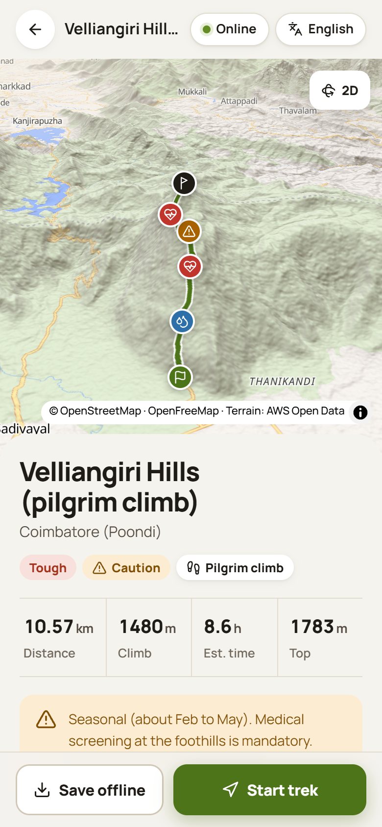
The pilgrim climb from Poondi: 5.29 km one way and 1,480 m of climbing, from 507 m to the summit at 1,783 m. Scroll to walk it.
0.00 km507 m
Start · 507 mSummit · 1,783 m
Trails in the app
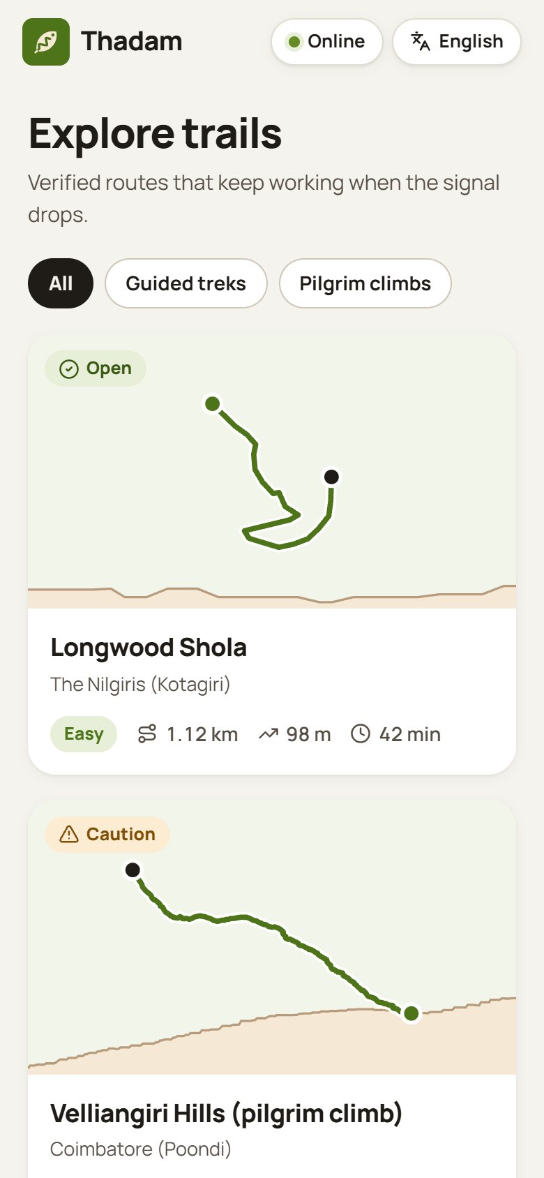
Starting with two very different climbs.
ToughPilgrim climb
Velliangiri Hills
Coimbatore (Poondi)
Distance
10.57 km
Climb
1,480 m
Est. time
8.6 h
Top
1,783 m
Seasonal, about February to May. Medical screening at the foothills is mandatory.
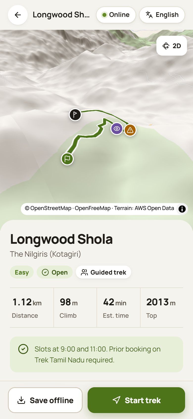
EasyGuided trek
Longwood Shola
The Nilgiris (Kotagiri)
Distance
1.12 km
Climb
98 m
Est. time
42 min
Top
2,013 m
Slots at 9:00 and 11:00. Book in advance on Trek Tamil Nadu.
More trails are on the way, including Sathuragiri, Parvathamalai and Kolli Hills.
Install
Get Thadam on your Android phone.
1
Download the APK
Tap Download on your phone. It's 6.6 MB.
2
Allow the install
Open the downloaded file. If Android asks, allow installs from your browser for this one app.
3
Save a trail before you go
Open Thadam, pick your trail and tap Save offline while you still have signal.
Why does Android show a warning?
Thadam isn't on the Play Store yet, so Android asks before installing an app downloaded from a website. Only download Thadam from this page. To check the file, compare its SHA-256 fingerprint with the one shown here.